The start to the morning was much better organised, and having all the necessary stuff distributed logically over just a shopping bag, a chilly bin, and the pack meant that I could try out my experiment tonight and camp out in the tent.
I was ready to go by about 9:00 even after having switched on the computer, gotten the reservation OK for Hamilton, and installed an update. Today’s drive was not going to be long, so there was plenty of time. Read more…
Couldn’t sleep the last hour or so, so I was up at 8:00 and had a very frugal breakfast of muesli bars, crackers and coffee. The car had to be properly organised for the rest of the trip and that took up the next 2 hours. The case was reserved for the rest of the books and fresh clothes, the pack takes on the computer and diaries in the main compartment, and the vanity bag in the bottom one, the chilly bin is packed full of spoilable food and other stuff that needs to be kept cold, and there is a shopping bag with non-spoilable food and the large shampoo etc. bottles. The camera bag is now loaded with batteries and cards; one A470 is ready to go in the glove box, and the SX120 is in its pocket in the pack. A notebook with pen is with the glasses & ipod in one of the open compartments on the passenger side. Almost 100% ready to go. Read more…
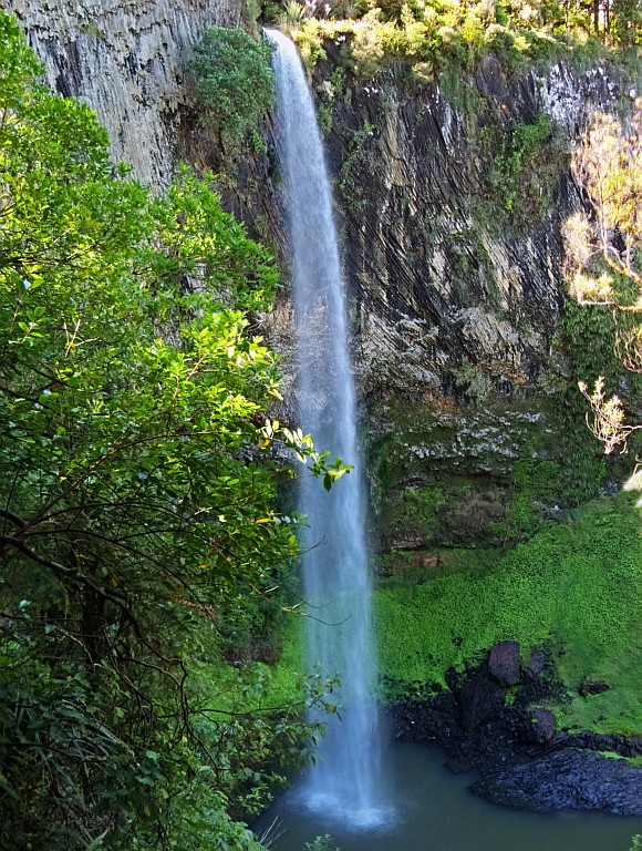
I had gotten a fairly good night’s sleep and was up and about just before Robert, and we had breakfast together: Cornflakes, a couple of poached eggs on toast, and coffee. After getting the stuff together that I needed for photography, I set off for the Bridal Veil Falls for the walk and photo session #1.
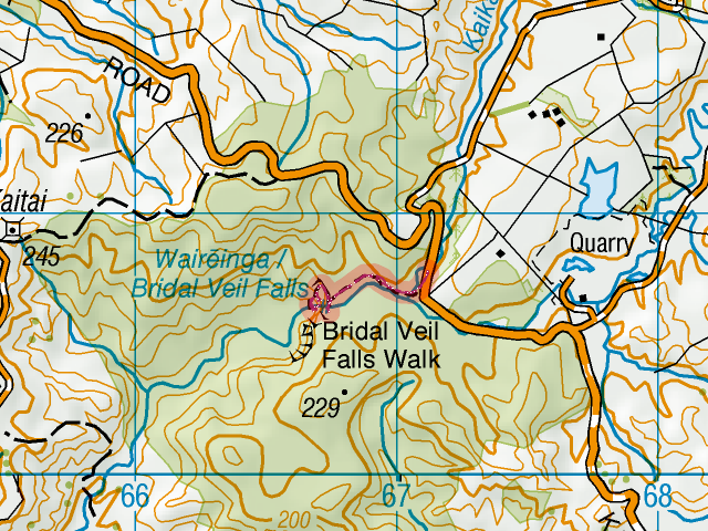
Bridal Veil FallsThe turnoff is a couple of kilometres down the road, and then a farther turnoff into the Kawhia Road led to a car park. Unfortunately the road is a dead end, otherwise I would have considered taking it to Kawhia, just to see the town again after 2009. Will have to see what alternatives there are.
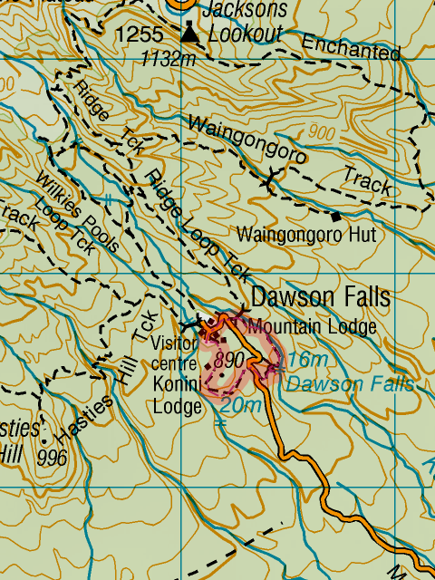
Short stroll, map detail. GPS: [download id="1739"], map: [download id="1691"]At the car park there were plenty of cars and not many signs of break-ins, so I took off in crocs as it was an easy walk. The waterfall is quite high (55 m) and the track starts at the top where the water disappears over the edge. There are a total of four lookouts, two at the top, one in the middle and one at the bottom. I started taking photos at the bottom with a time lapse of about half of the falls (first without, then with the filter) and repeated at the middle lookout (where the shooting had to be portrait orientation to capture the whole image) and at the top I got a time lapse of the water disappearing and a single shot of the “No abseiling” sign, although it is strangely out of focus. Read more…
Got up closer to 8:00 than previously the case and had breakfast before Simon turned up with his daily bread. That was the last of the eggs, so I will have to go shopping in the afternoon for something for tomorrow morning.
The Old Coach Road as a mountain bike trail was on the programme for today. I was ready to go just before 9:30 and cycling down Railway Row I seriously considered going back and trying on the breast mount for the camera. That wouldn’t have been such a good idea. Read more…
There wasn’t much sound from above, so at around 8:00 I went upstairs and the two were sleeping in. Couldn’t quite stomach breakfast and only had a coffee. Pretty soon the courier with my emergency equipment arrived which was audible because the guy had his radio playing loudly and I was able to intercept him before he had to search far. Eventually I. made an appearance and then Chinara, who busily telephoned around to organise the remainder of her day. Read more…
Slept through to 9:30 and didn’t hear Chinara leaving at 8. I wanted to do the Coast-to-Coast Walkway today (a section of the Te Araroa Track) and had a map prepared but … First of all, couldn’t find the glasses, then couldn’t find the file, except finally on the safe page on the web. WTH. Saved it to the laptop, packed the pack with only the laptop and some water, and was eventually ready to go by 12:00. Read more…