Category Archives: GPS Tracks

6. Taumarunui, Cherry Grove – Poukaria: Whanganui River Journey 1

Monday, February 16: Very cloudy to begin with but not as cold, reverting to sunshine with a few clouds

Poukaria Campsite (DOC, $14)

Kayaking: 35.7 km

GPS Tour
YouTube video

I awoke at about 5:30 and could hear Simon baking the ciabatta he had promised us. Was promptly up at 6:00 and had a breakfast of muesli and then scrambled eggs on toast and some coffee. Simon returned back to bed while I threw the rest of my stuff into the rucksack and a couple of shopping bags.

Pea was waiting for me at her place when I went over just before 7:00. Soon Gavin from Yeti Tours was there with his car to take us to the depot, a little scroungy looking, but these kayak people have their own laws. We had been fitted out for life jackets at the briefing yesterday and so only needed the boat, paddles and spray skirts. Then I realised I had forgotten the butter (in the fridge) and as we were leaving I asked Gavin to call past Sue & Simon’s place to pick it up. Read more…

3. Auckland, St Heliers: Rangitoto Sea Kayaking

Friday, February 13: Cloudy at first, clearing to light cloud with a bit of a southerly breeze

Chinara’s

Kayaking: 10.0 km
Tramping: 5.2 km

There wasn’t much sound from above, so at around 8:00 I went upstairs and the two were sleeping in. Couldn’t quite stomach breakfast and only had a coffee. Pretty soon the courier with my emergency equipment arrived which was audible because the guy had his radio playing loudly and I was able to intercept him before he had to search far. Eventually I. made an appearance and then Chinara, who busily telephoned around to organise the remainder of her day. Read more…

2. Auckland: Coast-to-Coast

Thursday, February 12: Overcast throughout the day, clearing a little in the evening

Tramping: Coast to Coast (Te Araroa), 16.3 km

Chinara’s

Slept through to 9:30 and didn’t hear Chinara leaving at 8. I wanted to do the Coast-to-Coast Walkway today (a section of the Te Araroa Track) and had a map prepared but … First of all, couldn’t find the glasses, then couldn’t find the file, except finally on the safe page on the web. WTH. Saved it to the laptop, packed the pack with only the laptop and some water, and was eventually ready to go by 12:00. Read more…

Ironman III: Tramping

And yes, the land had to be conquered as well. After having struggled for so long to try to find what remains of the Weser Path between Porta Westfalica and Bremen, I went through all the stages in the early part of the year, but this time from north to south. Not many signs left, so I will have to see about publishing the results sometime. Read more…

Ironman II: Kayaking

Get in your waka
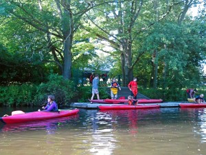
Get in your waka. Leaving the university sports jetty. © 2014 by Christoph Tyblewski, used with kind permission

There is historical evidence for the use of kayaks from the tour of 1974/75, although in my naïveté I called them “canoes” or “dinghies” at the time. The diary entry for Tuesday, January 7, 1975 at Blackwood Bay commences:

“I slept in again, and later went out on a canoe.”

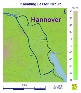
Lesser Circuit
Lesser Circuit, September 13
I say this because I had booked myself into the uni sports’ flat water paddling group, turned up on time, was given a boat, and then proceeded to make myself into a best example of the Dunning-Kruger effect. After a little more than 100 m of floundering about, I was ordered into the Canadian canoe that is reserved for the less skilled. But in the second week in the Canadian, I met Conny, so it wasn’t all that bad. She basically gave me a rundown of her life so far, which included a stint at Monash, as well as Russia and Japan, and my diary of the following night only had one topic. Read more…