Bark Bay – Awaroa (14.2 km)
Thursday, February 28: Sunny all the day, a couple of clouds in the afternoon
GPS Tour
Youtube Video 1, Videos 2 & 3
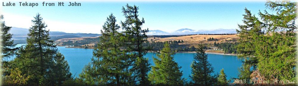
Was awoken by some giggle girls at around 6:30 who were throwing billies around. Had my breakfast, washed and was keeping an eye on the lagoon to see when water might be entering it. A girl asked to use my gas can which I gave her; then I discovered an abandoned one on one of the aluminium benches, which we swapped when she returned mine. Packed up all my stuff except the camera and then headed across the still dry lagoon for today’s shoot.
Since the tide was on its way in, and there were two sections of the later track that could only be crossed at low tide with no alternative, I guessed I could use up the whole morning on some photographic extravaganza. The idea was to capture one whole filling sequence as a time sequence bracketed three-fold (± 1 EV) every fifteen seconds until the lagoon was full or the batteries ran out. First I did a couple of shots without bracketing, then activated the bracketing and let the camera take control just as the first wave visibly rippled up the creek. Most of the action was over in about the first hour or so. Chatted with a couple of people passing by and marked the passage of time with a sundial in the sand.
Eventually the water reached the tripod and that was within a couple of centimetres the highest tide. The battery was running low, but not dangerously so, but as I have over 570 sets of photos, that was enough for one morning. Went back to the hut the long way, had my lunch with what appeared to be a couple of day trippers, then set off for today’s hike.
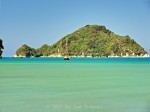
Tonga Island (bracketed)
| GPS Tour: Abel Tasman Coastal Track: Bark Bay – Awaroa |
|---|
Dinner will be rice, instant noodles and mixed veg. The hut has no free eastern side so that precludes a moonrise series; but perhaps there will be some colours for a sunset one. Sort of regret not having two cameras with me, because photographing the set up this morning would have been neat, and having a second camera for a sunset is as well.
Sunset was a bit of a flop and went to bed at about 9:00 since everybody wants to be up at 6:00 to cross the river in time.
Ordinary:
Director’s Cut: