And, finally, the book

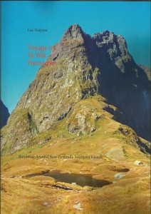
Voyage to Te Wai Pounamu, available in all good bookstores.

Voyage to Te Wai Pounamu, available in all good bookstores.

Yep, it took a little longer than expected, but after one long slog of 14 days, I got the book together and had it published. Look it up on amazon, where you’ll pay €43.90 for 128 action filled pages, 90 of which have coloured photos (more than 170 coloured images in total, with another 25 or so in black and white).

And that’s it folks, until the next adventure begins! Continue reading

Epilogue: Introducing GEOrgET

GEOrgET logo

GEOrgET logo

Recording many a track with GPS over the years and collecting heaps of data (as was also done on this trip, and hopefully, on some to come) means having to use GoogleEarth to view and edit the data. But GE has many a drawback, e.g. paths can’t be joined, or reversed, and GE’s automatic “tour” algorithm results often enough in simply bouncing around the countryside, instead of viewing it. Therefore it is with great pleasure that I can announce the publication of GEOrgET, the Google Earth Organiser, Editor and Toolkit. This is free software, licensed under the GPL, and resides here. Go download. Continue reading

Epilogue: On the Precariousness of Technology

Technology played a key role before, during, and after this trip. It was not only a question of having been there and done that, but also one of preparing the spoils for showing afterwards. Therefore it was sobering on many occasions to see how close I came to Wallace’s tragedy. Continue reading

52. Akaroa Skyline

Bon Accord
Tuesday, March 26: A little cloudy at first, becoming sunny with a bit of a cool breeze
GPS Tour
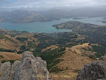
Akaroa from the Skyline Track

Akaroa from the Skyline Track

Went down to the i-SITE to get a brochure on a walk for today and stopped by at the library to download the podcasts as the 50 MB limit in the hostel would have been quickly used up. Bought some sandwiches (ham & mustard; corned beef & piccalilly) from the supermarket for lunch and then set off up the hill. Continue reading

49. Mt Somers – Sharplin Falls

Redwood Lodge
Saturday, March 23: Sunny at first, later clouding the western half of the sky
GPS Tour

Not up so early this morning and had a bit of a frog in my throat and about half a cold. Was out of here just after 10 to attempt the mountain, but was feeling so poorly that I could only see how far I could get. Continue reading

47. Twizel – Mt Cook

Ruataniwha Holiday Park
Thursday, March 21: Some dewfall at night, sunny with few clouds during the day
GPS Tour
Mt Sefton Panorama

Mt Sefton Panorama

Was up at 7:00 to try to get a longer walk done today. Breakfast was a little complicated by having to use the hiking crockery & cutlery and having to wash and dry it. However, that dealt with and lunch packed away I took off for the mountain and could see it most of the way along the SH 80. Continue reading

39. Milford Track, Day 4

Dumpling – Sandfly Point (22.1 km)
Steamers Beach (see March 6, 2013)
Wednesday, March 13: Some low cloud at first, clearing with dramatic cloud patches left behind. In Te Anau hot
GPS Tour
Youtube video
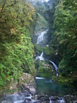
Mackay Falls, exposure bracket

Mackay Falls, exposure bracket

A few were up from 6:30 onwards, and Andrea & Kobi seemed to have difficulty getting up at their 6:45 target; but in any case I had enjoyed a restful night’s sleep and was pretty much ready to go. Only Franklin had started snoring once, but I woke him and got him to turn on his side; and the Belgian guy did snore very softly and it was over when he turned. The Israeli guys were impeccable. All in all we were about 95% snore-free which, for an impromptu revolt, was not bad. Continue reading

38. Milford Track, Day 3

Mintaro – Dumpling Hut (18.5 km)
Tuesday, March 12: Some low cloud at first, afterwards sunny throughout
GPS Tour
Youtube video
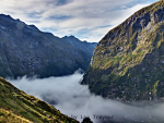
Fog blankets the Clinton Valley in the early morning

Fog blankets the Clinton Valley in the early morning

The republic of non-snorers had its first success last night; except for one snorer who had slipped in, and Mark who snored a little around 6:00, we were 90% or more snore-free.

So the wake-up call was just after 6:00 when people started to congregate in the kitchen. Had my breakfast and let most people leave before me, before brushing my teeth and sending an OK with the spot. Just after a couple of posh hikers arrived to check out our digs, I took off up the track. Continue reading

37. Milford Track, Day 2

Clinton – Mintaro Hut (20.6 km), excursion to Mackinnon Pass (8.0 km)
Monday, March 11: Cloudy at first, with a few drops of rain, later mainly sunny with a few clouds
GPS Tour
Youtube Video
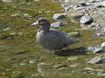
Whio (“blue duck” – Hymenolaimus malacorhynchos) wading in the Clinton River

Whio (“blue duck” – Hymenolaimus malacorhynchos) wading in the Clinton River

Was up at 6:00 – surprisingly snore-free night, although the other hut had copped more than its share of snorers – and had breakfast with Alissa (student of landscape architecture) before most people were out and about. Packed up my stuff and was away just after 8:00, after sending an OK with the spot tracker & getting a satellite fix for the GPS. First partner was Franklin (engineer from New York) and then we caught up with Alissa who was visiting all of the ponds. Lots of shots of robins playing around and saw a whio flying at a pool @ 4 miles. Continue reading

36. Milford Track, Day 1

Glade Wharf – Clinton Hut (7.1 km)
Sunday, March 10: Cloud at first, then mainly sunny apart from one cloudy period
GPS Tour
Youtube Video
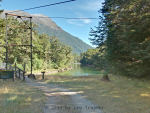
Bridge over the River Clinton at Glade Lodge

Bridge over the River Clinton at Glade Lodge

Up at 7:30, which was cutting it fairly fine, especially after the cooked breakfast of baked beans from some abandoned food and fried eggs took about twice as long to prepare as it should have, due to the defective can opener. Continue reading